
Barbados Google Maps is a site/tool that offers a wide range of map views (topographic, satellite, street view) and navigation options, with little effort on your part, yet efficiently. If you need to plan a trip to a new place like Barbados, Google maps are available on desktop, mobile, or tablet. This Google maps and information page is dedicated to Barbados, Central America, and the Caribbean (35 countries), showing its location, country facts, details about its capital city Bridgetown, bordering countries like none, and plenty of other information which may be interesting when you visit this Central American and the Caribbean state.
Quick links: Google maps Barbados, Bridgetown Google maps, Driving Directions Barbados, Printable Road Map.
About Barbados in a nutshell
- Barbados retains a strong British influence and is referred to by its neighbors as “Little England”.
- Conventional short form of the name: Barbados
- The conventional long form of the name: none
- Etymology: the name derives from the Portuguese as barbadas, which means the bearded ones and can refer either to the long, hanging roots of the islands bearded fig trees or to the alleged beards of the native Carib inhabitants.
- The legal system in Barbados: English common law; no judicial review of legislative acts.
- Climate: Moderate tropical climate. Sunnier and drier than its more mountainous neighbors.
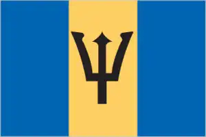
- The national symbols are Neptunes trident, pelican, Red Bird of Paradise flower (also known as Pride of Barbados); national colors: blue, yellow, black.
- Internet TLD: .bb
Background
The island was uninhabited when first settled by the British in 1627. Enslaved Africans worked the sugar plantations established on the island, which initially dominated the Caribbean sugar industry. By 1720 Barbados was no longer a dominant force within the sugar industry, having been surpassed by the Leeward Islands and Jamaica. Slavery was abolished in 1834.
The Barbadian economy remained heavily dependent on sugar, rum, and molasses production through most of the 20th century. The gradual introduction of social and political reforms in the 1940s and 1950s led to complete independence from the UK in 1966. In the 1990s, tourism and manufacturing surpassed the sugar industry in economic importance. Barbados plans to remove the British monarch as its head of state by November 2021 and transition to a republic.
Geography
Encircled by coral reefs. Fertile and predominantly flat, with a few gentle hills to the north.
Barbados is the most easterly of the Caribbean islands. Once solely inhabited by the native Arawak, British settlers first colonized Barbados in the 1620s.
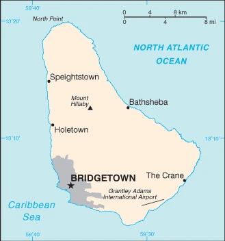
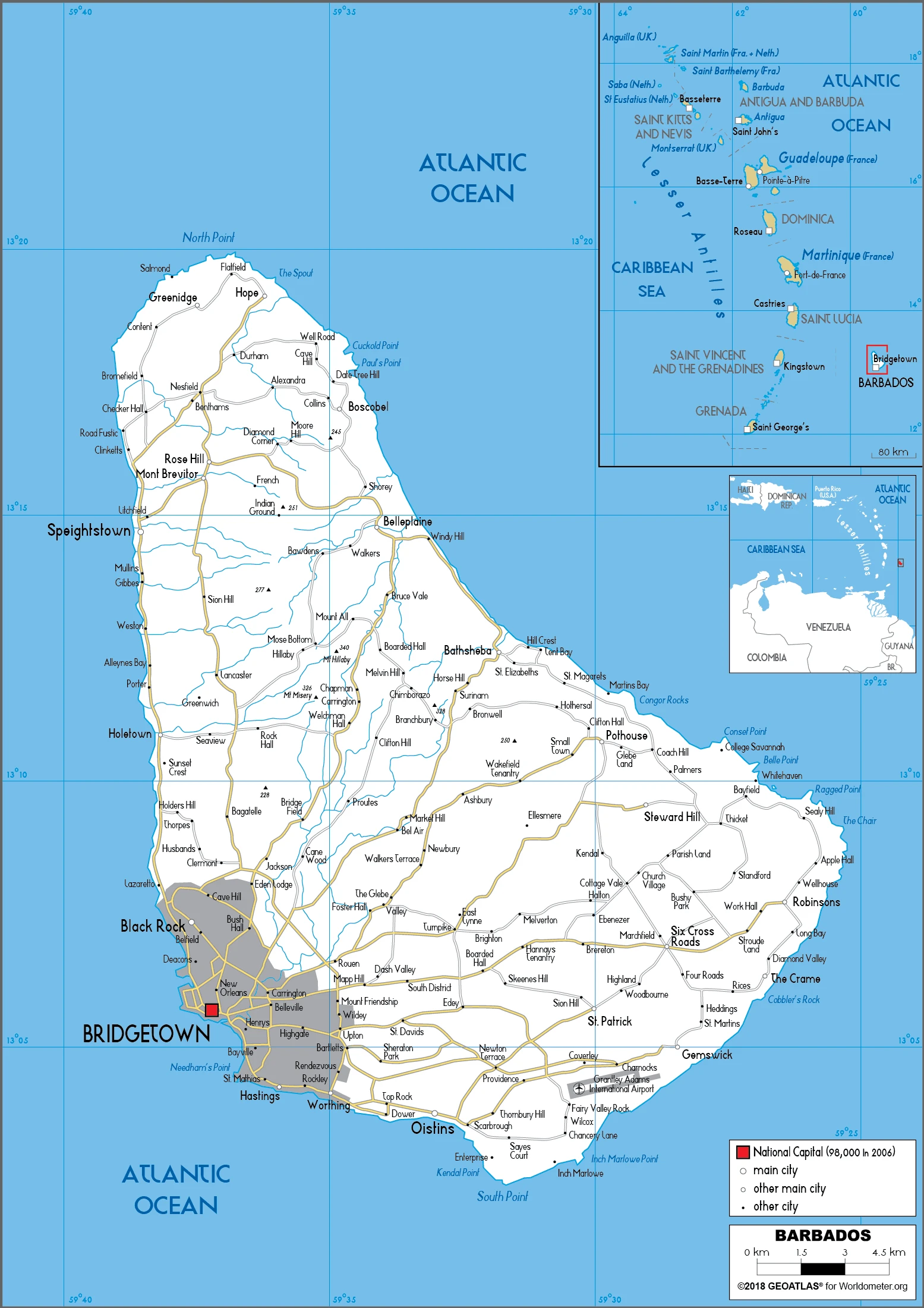
This state is located in the Caribbean, an island in the North Atlantic Ocean, northeast of Venezuela, under the coordinates of 13 10 N, 59 32 W, covering an area of 430 sq km with a coastline of 97 km. Barbados is 2.5 times the size of Washington, DC.
Barbados has 0 km of land boundaries in total and borders with none.
Relatively flat, it rises gently to the central highland region, with Mount Hillaby 336 m as the highest point of Barbados, while the Atlantic Ocean 0 m as the lowest point, causing a mean elevation at N/A throughout the country. With a total of 430 sq km, Barbados has 430 sq km of land and 0 sq km water surface area.
Easternmost Caribbean island.
The climate in Barbados is as follows: Tropical, rainy season (June to October).
When you visit Barbados, the natural hazards shall be considered: Infrequent hurricanes; periodic landslides.
The following major health-threatening issues shall be considered when visiting Barbados: none.
Current environmental issues affecting the Barbadian or Bajan (colloquial) people: pollution of coastal waters from waste disposal by ships; soil erosion; illegal solid waste disposal threatens contamination of aquifers.
Google maps Barbados
The capital and other divisions
Capital city: Bridgetown found under the coordinates 13 06 N, 59 37 W, applying the time zone UTC-4 (1 hour ahead of Washington, DC, during Standard Time), using the following daylight saving time: none.
Bridgetown, the capital of Barbados and its most populous city, is a destination for travelers seeking beach life, vibrant nightlife, and historical sites.
Barbados became independent on 30 November 1966 (from the UK), and its national holiday is Independence Day, 30 November (1966).
Administrative divisions: 11 parishes and 1 city*; Bridgetown, Christ Church, Saint Andrew, Saint George, Saint James, Saint John, Saint Joseph, Saint Lucy, Saint Michael, Saint Peter, Saint Philip, Saint Thomas.
People and society
Independent from the UK since 1966. Some latent tension between the economically dominant white community and the majority black population, but violence is rare. Increasing social mobility has enabled black Barbadians to enter the professions. Despite political stability and good welfare and education services, pockets of abject poverty remain.
The population in Barbados is 301,865 (July 2021 estimate), with an average of 0.28% (2021 estimate) change. That means Barbados is the No. 180 in the world’s populated rank list. With an average of 39.5 years median age (38.4 years for males and 38.4 years for women), Barbados ranks No. 55 on the globe’s median age rank list.
The people living in this country are the Barbadian(s) or Bajan (colloquial) (noun) or Barbadian or Bajan (colloquial) (adjective) and belong mainly to the following ethnic groups: African descent 92.4%, mixed 3.1%, White 2.7%, East Indian 1.3%, other 0.2%, unspecified 0.3% (2010 estimate).
They speak English (official language), Bajan (English-based creole language, widely spoken in informal settings) languages and practice the following religions: Protestant 66.4% (includes Anglican 23.9%, other Pentecostal 19.5%, Adventist 5.9%, Methodist 4.2%, Wesleyan 3.4%, Nazarene 3.2%, Church of God 2.4%, Baptist 1.8%, Moravian 1.2%, other Protestant 0.9%), Roman Catholic 3.8%, other Christian 5.4% (includes Jehovahs Witness 2.0%, other 3.4%), Rastafarian 1%, other 1.5%, none 20.6%, unspecified 1.2% (2010 estimate).
We can conclude the following about the population in Barbados: The most densely populated country in the eastern Caribbean. Approximately one-third live in urban areas. In Barbados, we are talking about 31.2% (2021) of the total population is living in cities, and most of them reside in the following municipalities: 89,000 Bridgetown (capital city) (2018).
Industry
Well-developed tourism sector based on climate and accessibility. Financial services, offshore banking, and information processing are vital industries. Sugar production has dwindled. High cost of living.
Barbados is the wealthiest and one of the most developed countries in the Eastern Caribbean and enjoys one of the highest per capita incomes in the region. Historically, the Barbadian economy was dependent on sugarcane cultivation and related activities. However, the economy has diversified into light industry and tourism. Offshore finance and information services are important foreign exchange earners, boosted by being in the same time zone as eastern US financial centers and a relatively highly educated workforce. Following the 2008-09 recession, external vulnerabilities such as fluctuations in international oil prices have hurt economic growth, raised Barbados’s already high public debt to GDP ratio – which stood at 105% of GDP in 2016 – and cut into its international reserves.
Barbados is rich in the following natural resources: Petroleum, fish, natural gas.
The main industrial sectors are typically tourism, sugar, light manufacturing, component assembly for export.
The country’s export sectors are particularly strong in rums and other hard liquor, ships, orthopedic appliances, cement, packaged medicines (2019), partnering with these nations: the US 21%, Poland 14%, Jamaica 8%, Guyana 6%, Trinidad and Tobago 6% (2019). The export trade resulted in $485.4 million. Note: Data are in current year dollars (2017 estimate). In a global rank of the export, values resulted in Barbados’s position of 191.
Land use in Barbados: 19.4% (2018 estimate) forest, 48% (2018 estimate) other.
The arable land area is 25.6% (2018 estimate), and the agricultural land is 32.6% (2018 estimate). Land use for permanent crops 2.3% (2018 estimate), permanent pasture 4.7% (2018 estimate). The sum of the area of the irrigated land is 50 sq km (2012).
The main agro-industrial products of Barbados are sugar cane, poultry, vegetables, milk, eggs, pork, coconuts, pulses nes, sweet potatoes, tropical fruit.
The country typically needs to import: refined petroleum, ships, cars, shipping containers, packaged medicines (2019), partnering with the following nations: the United States 35%, Trinidad and Tobago 14%, China 9%, Netherlands 5% (2019) in a sum value of $1.52 billion (2017 estimate) $1.541 billion (2016 estimate). This sum value on the global ranking list of imports resulted in Barbados 180.
Barbados Driving Directions
In this post, you learned about Barbados, the Caribbean, island in the North Atlantic Ocean, northeast of Venezuela. We published some basic information about its capital Bridgetown, and the Barbadian or Bajan (colloquial) nation.
Are you interested in visiting Barbados and looking for driving directions? Click here to plan your route, or see a printable road map of Barbados below for an overview of the route network.
Printable map of Barbados
Did you know about Barbados?
The island’s name comes from the Portuguese word for “bearded,” after first European visitors saw local people with facial hair.
Barbados is one of the most popular destinations for scuba divers. The island has the highest concentration of pink sand beaches in the world. The country has over 50 beaches and offers some of the most beautiful scenery that you will find anywhere on earth.
After virtually visiting Barbados, you may also be interested in the neighboring countries: none.
If you liked our Google map and Barbados information page,
please share it with others or save the link https://www.drivingdirections.net in your bookmarks.