Belarus Google Maps is a site/tool that offers a wide range of map views (topographic, satellite, street view) and navigation options, with little effort on your part, yet efficiently. If you need to plan a trip to a new place like Belarus, Google maps are available on desktop, mobile, or tablet. This Google maps and information page is dedicated to Belarus, Europe (47 countries), showing its location, country facts, details about its capital city Minsk, bordering countries like Latvia, Lithuania, Poland, Russia, Ukraine, and plenty of other information which may be interesting when you visit this European state.
Quick links: Google maps Belarus, Minsk Google maps, Driving Directions Belarus, Printable Road Map.
About Belarus in a nutshell

- Conventional short form of the name: Belarus
- The conventional long form of the name: Republic of Belarus
- Local long form: Respublika Byelarus/Respublika Belarus,
- Local short form: Byelarus / Belarus
- Former name(s): Belorussian (Byelorussian) Soviet Socialist Republic
- Etymology: the name is a compound of the Belarusian words bel (white) and Rus (the Old East Slavic ethnic designation) to form the meaning White Rusian or White Ruthenian.
- The legal system in Belarus: civil law system;.
- Climate: Extreme continental climate. Winters are long, sub-freezing, but mainly dry
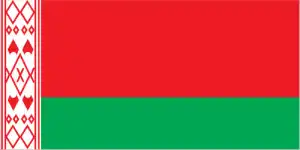
- The national symbols are no clearly defined current national symbol, the mounted knight known as Pahonia (the Chaser) is the traditional Belarusian symbol; national colors: green, red, white.
- Internet TLD: .by
In Belarus, a former member republic of the Soviet Union, the German-Polish Plain passes gradually into the mixed forest belt of the Eastern European Plain. Dense forests once covered it, but by the 16th century, most of the forests had been cleared. In the 20th century, however, some areas were reforested, and today Europe’s most giant patch of mixed forest is located in the Bjelovescsaja Puscsa/Bielowieza National Park in Poland. The park is home to the most significant European bison population – around 300 individuals – and is a World Natural Heritage Site. Among Belarus’s World Heritage Sites, Mir’s castle, founded in the late 15th century, was initially built in the Gothic style, with Renaissance and Baroque elements added during later renovations. It was severely damaged during the Napoleonic Wars but was rebuilt at the end of the 19th century when the surrounding park was restored to its present form. The list is completed by the ten-building palace complex of the Radzivil dynasty’s residence in Nesvizh, which ruled the country from the 16th century until 1939 and had a significant influence on science, art, and architecture as the church and the Struve survey network in Belarus.
The number of cancer and leukemia cases soared after the 1986 Chernobyl disaster.
Background
After seven decades as a constituent republic of the USSR, Belarus attained its independence in 1991. It has retained closer political and economic ties to Russia than have any of the other former Soviet republics. Belarus and Russia signed a treaty on a two-state union on 8 December 1999, envisioning greater political and economic integration. Although Belarus agreed to a framework to carry out the accord, serious implementation has yet to occur, and current negotiations on further integration have been contentious. Since his election in July 1994 as the country’s first and only directly elected president, Aleksandr LUKASHENKO has steadily consolidated his power through authoritarian means and a centralized economic system. Government restrictions on political and civil freedoms, freedom of speech and the press, peaceful assembly, and religion have remained.
Geography
Mainly plains and low hills. The Dnieper and Dvina rivers drain the eastern lowlands. Vast Pripet Marshes in the southwest.

White Russia Belarus lies landlocked in Eastern Europe. It reluctantly became independent when the USSR broke up in 1991. It has few resources other than agriculture.
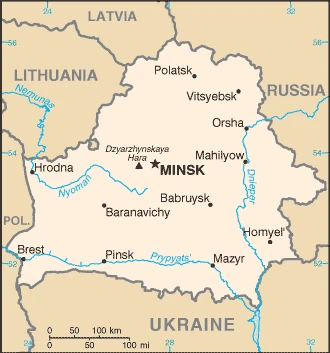
This state is located in Eastern Europe, east of Poland, under the coordinates of 53 00 N, 28 00 E, covering an area of 207 600 sq km with a coastline of 0 km (landlocked country). Belarus is Slightly less than twice the size of Kentucky; slightly smaller than Kansas.
Belarus has 3,599 km of land boundaries in total and borders with (5 nations): Latvia 161 km, Lithuania 640 km, Poland 375 km, Russia 1312 km, Ukraine 1111 km.
Generally flat with much marshland, with Dzyarzhynskaya Hara 346 m as the highest point of Belarus, while Nyoman River 90 m as the lowest point, causing a mean elevation at 160 m throughout the country. With a total of 207 600 sq km, Belarus has 202 900 sq km of land and 4700 sq km water surface area.
The principal rivers are Dnieper (shared with Russia s and Ukraine m) – 2,287 km. The significant watersheds for Belarus are Atlantic Ocean drainage: (Black Sea) Dnieper (533,966 sq km).
landlocked; glacial scouring accounts for the flatness of Belarusian terrain and its 11,000 lakes
The climate in Belarus is as follows: Cold winters, cool and moist summers, transitional between continental and maritime.
When you visit Belarus, the natural hazards shall be considered: Large tracts of marshy land.
The following major health-threatening issues shall be considered when visiting Belarus: none.
Current environmental issues affecting the Belarusian people: soil pollution from pesticide use; southern part of the country contaminated with fallout from 1986 nuclear reactor accident at Chornobyl in northern Ukraine.
Google maps Belarus
The capital and other divisions
Capital city: Minsk found under the coordinates 53 54 N, 27 34 E, applying the time zone UTC+2 (7 hours ahead of Washington, DC, during Standard Time), using the following daylight saving time: none.
Minsk is a city in Belarus and one of the most important cities in the country. There are many museums in Minsk, and there is also an opera house inside its central park. Minsk is an important cultural center for Belarus, and it still manages to maintain its art nouveau architecture.
Belarus became independent on 25 August 1991 (from the Soviet Union), and its national holiday is Independence Day, 3 July (1944).
Administrative divisions: 6 provinces (voblastsi, singular – voblasts) and 1 municipality (horad); Brest, Homyel (Gomel), Horad Minsk (Minsk City), Hrodna (Grodno), Mahilyow (Mogilev), Minsk, Vitsyebsk (Vitebsk): Note: administrative divisions have the same names as their administrative centers; Russian spelling provided for reference when different from Belarusian.
People and society
Only 2% of people are non-Slav, so ethnic tension is minimal. Russian culture dominates. Belarus was the slowest ex-Soviet state to implement political reform; President Lukashenka has been labeled as Europes last dictator. Enthusiasm for a merger with Russia has waned. A small ex-Communist elite holds wealth. The fallout from the 1986 Chernobyl nuclear disaster in Ukraine still seriously affects health and the environment.
The population in Belarus is 9,441,842 (July 2021 estimate), with an average of -0.29% (2021 estimate) change. That means Belarus is the No. 94 in the world’s populated rank list. With an average of 40.9 years median age (38 years for males and 38 years for women), Belarus ranks No. 48 on the globe’s median age rank list.
The people living in this country are the Belarusian(s) (noun) or Belarusian (adjective) and belong mainly to the following ethnic groups: Belarusian 83.7%, Russian 8.3%, Polish 3.1%, Ukrainian 1.7%, other 2.4%, unspecified 0.9% (2009 estimate).
They speak Russian (official language) 70.2%, Belarusian (official language) 23.4%, other 3.1% (includes small Polish- and Ukrainian-speaking minorities), unspecified 3.3% (2009 estimate) languages and practice the following religions: Orthodox 48.3%, Catholic 7.1%, other 3.5%, non-believers 41.1% (2011 estimate).
We can conclude the following about the population in Belarus: A fairly even distribution throughout most of the country, with urban areas attracting larger and denser populations. In Belarus, we are talking about 79.9% (2021) of the total population is living in cities, and most of them reside in the following municipalities: 2.039 million, Minsk (capital city) (2021).
Industry
The industry is old-fashioned and mainly state-owned. Depends on Russia for energy and raw materials: tensions over natural gas prices.
As part of the former Soviet Union, Belarus had a relatively well-developed industrial base. Still, it is now outdated, inefficient, and dependent on subsidized Russian energy and preferential access to Russian markets. The country’s agricultural base is mainly dependent on government subsidies. Following the collapse of the Soviet Union, an initial burst of economic reforms included privatization of state enterprises, creation of private property rights, and the acceptance of private entrepreneurship, but by 1994 the reform effort dissipated. About 80% of the industry remains in state hands, and foreign investment has virtually disappeared.
Several businesses have been renationalized. State-owned entities account for 70-75% of GDP, and state banks make up 75% of the banking sector. Economic output declined for several years following the break-up of the Soviet Union but revived in the mid-2000s. Belarus has only tiny oil reserves and imports crude oil and natural gas from Russia at subsidized, below-market prices. Belarus derives export revenue by refining Russian crude and selling it at market prices. Russia and Belarus have had serious disagreements over prices and quantities for Russian energy. Beginning in early 2016, Russia claimed Belarus began accumulating debt reaching $740 million by April 2017 for paying below the agreed price for Russian natural gas. Russia cut back its export of crude oil due to the debt. In April 2017, Belarus agreed to pay its gas debt, and Russia restored the flow of crude. New non-Russian foreign investment has been limited in recent years, primarily because of an unfavorable financial climate.
In 2011, a financial crisis led to a nearly three-fold devaluation of the Belarusian ruble. The Belarusian economy has struggled with high external debt servicing payments and a trade deficit. In mid-December 2014, the devaluation of the Russian ruble triggered a near 40% devaluation of the Belarusian ruble. Belarus’s economy stagnated between 2012 and 2016, widening productivity and income gaps between Belarus and neighboring countries. Budget revenues dropped because of falling global prices on essential Belarusian export commodities. Since 2015, the Belarusian government has tightened its macro-economic policies, allowed more flexibility to its exchange rate, taken some steps towards price liberalization, and reduced subsidized government lending to state-owned enterprises. Belarus returned to modest growth in 2017, primarily driven by improving external conditions. Belarus issued sovereign debt for the first time since 2011, which provided the country with badly-needed liquidity. It issued $600 million worth of Eurobonds in February 2018, predominantly to US and British investors.
Belarus is rich in the following natural resources: Timber, peat deposits, small quantities of oil and natural gas, granite, dolomitic limestone, marl, chalk, sand, gravel, clay.
The main industrial sectors are typically metal-cutting machine tools, tractors, trucks, earthmovers, motorcycles, synthetic fibers, fertilizer, textiles, refrigerators, washing machines, and other household appliances.
The country’s export sectors are particularly strong in refined petroleum, fertilizers, cheese, delivery trucks, crude petroleum (2019), partnering with these nations: Russia 42%, Ukraine 13%, the United Kingdom 7% (2019). The export trade resulted in $37.04 billion. Note: Data are in current year dollars (2020 estimate). In a global rank of the export, values resulted in Belarus’s position of 69.
Land use in Belarus: 42.7% (2018 estimate) forest, 13.6% (2018 estimate) other.
The arable land area is 27.2% (2018 estimate), and the agricultural land is 43.7% (2018 estimate). Land use for permanent crops 0.6% (2018 estimate), permanent pasture 15.9% (2018 estimate). The sum of the area of the irrigated land is 1,140 sq km (2012).
The main agro-industrial products of Belarus are milk, potatoes, sugar beet, wheat, triticale, barley, maize, rye, rapeseed, poultry.
The country typically needs to import: crude petroleum, natural gas, cars and vehicle parts, packaged medicines, broadcasting equipment (2019), partnering with the following nations: Russia 57%, China 7%, Poland 5%, Germany 5%, Ukraine 5% (2019) in a sum value of $35.16 billion. Note: data are in current year dollars (2020 estimate) $42.38 billion. Note: data are in current year dollars (2019 estimate) $41.34 billion. Note: data are in current year dollars (2018 estimate). This sum value on the global ranking list of imports resulted in Belarus 68.
Belarus Driving Directions
In this post, you learned about Belarus, Eastern Europe, east of Poland. We published some basic information about its capital Minsk, and the Belarusian nation.
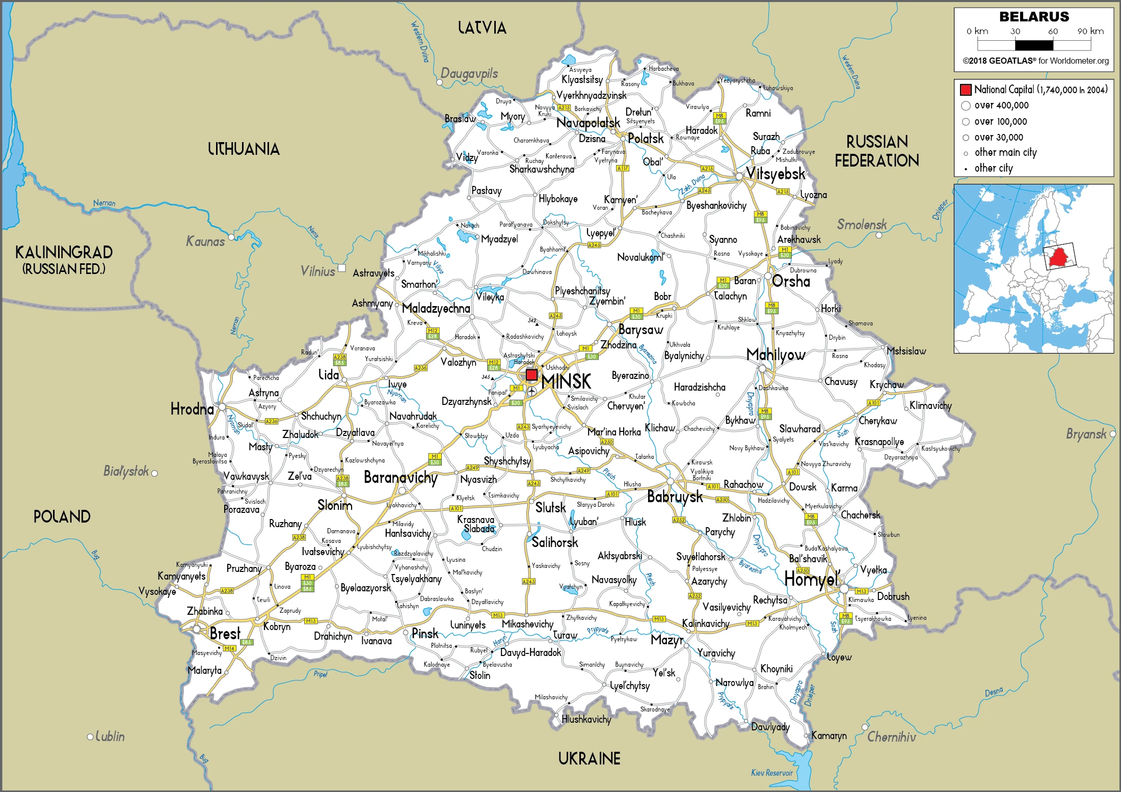
Are you interested in visiting Belarus and looking for driving directions? Click here to plan your route, or see a printable road map of Belarus below for an overview of the route network.
Printable map of Belarus
Did you know about Belarus?
Belarus is a country located in Eastern Europe. The history of Belarus dates back to the 9th century when the first East Slavic state, called Kievan Rus, was established by Oleg. In 1019, another East Slavic state was formed and named the berry that grows abundantly throughout Belarus: Bryansk. The country has changed names several times over the centuries and currently goes by the Republic of Belarus.
Belarusian belongs to the Eastern European language group, which shares many linguistic similarities with Russian.
After virtually visiting Belarus, you may also be interested in the neighboring countries: Latvia, Lithuania, Poland, Russia, Ukraine.
If you liked our Google map and Belarus information page,
please share it with others or save the link https://www.drivingdirections.net in your bookmarks.

