
Isle of Man Google Maps is a site/tool that offers a wide range of map views (topographic, satellite, street view) and navigation options, with little effort on your part, yet efficiently. If you need to plan a trip to a new place like the Isle of Man, Google maps are available on desktop, mobile, or tablet. This Google maps and information page is dedicated to Isle of Man, Europe (47 countries), showing its location, country facts, details about its capital city Douglas, and plenty of other information which may be interesting when you visit this European state.
Quick links: Google Maps Isle of Man, Douglas Google maps, Driving Directions Isle of Man, Printable Road Map.
About Isle of Man in a nutshell
- Conventional short form of the name: Isle of Man
- The conventional long form of the name: none
- Etymology: the name man may be derived from the Celtic word for mountain.
- The legal system in Isle of Man: the laws of the UK apply where applicable and include Manx statutes.
- Climate: Temperate, cool summers and mild winters, overcast about a third of the time.
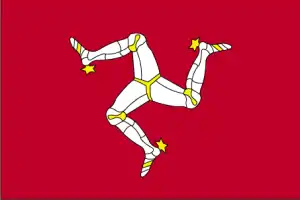
- The national symbols are triskelion (a motif of three legs); national colors: red, white.
- Internet TLD: .im
Background
Part of the Norwegian Kingdom of the Hebrides until the 13th century, when it was ceded to Scotland, the isle came under the British Crown in 1765. Current concerns include reviving the almost extinct Manx Gaelic language. The Isle of Man is a British Crown dependency, making it a self-governing possession of the British Crown that is not part of the U.K. HOWEVER, the U.K. Government remains constitutionally responsible for its defense and international representation.
Geography
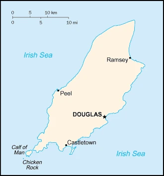
The Isle of Man is a small British Crown dependency in the Irish Sea, located between Great Britain and Ireland. The island has a population of about 83,000 and is slightly larger than Washington, D.C., making it one of the flattest countries globally, with an average elevation of just 4 meters.
This state is located in Western Europe, an island in the Irish Sea, between Great Britain and Ireland, under the coordinates of 54 15 N, 4 30 W, covering an area of 572 sq km with a coastline of 160 km. Isle of Man is Slightly more than three times the size of Washington, DC.
Hills in north and south bisected by a central valley, with Snaefell 621 m as the highest point of Isle of Man, while the Irish Sea 0 m as the lowest point, causing a mean elevation at 4 meters throughout the country. With a total of 572 sq km, the Isle of Man has 572 sq km of land and 0 sq km of water surface area.
One small islet, the Calf of Man, lies to the southwest and is a bird sanctuary.
The climate in the Isle of Man is as follows: Temperate, cool summers and mild winters, overcast about a third of the time.
When you visit the Isle of Man, the natural hazards shall be considered: Occasional high winds and rough seas.
The following major health-threatening issues shall be considered when visiting the Isle of Man: none.
Current environmental issues affecting the Manx people: air pollution, marine pollution, waste disposal (both household and industrial).
Google Maps Isle of Man
The capital and other divisions
Capital city: Douglas found under the coordinates 54 09 N, 4 29 W, applying the time zone UTC 0 (5 hours ahead of Washington, DC, during Standard Time), using the following daylight saving time: +1hr, begins last Sunday in March; ends last Sunday in October.
Douglas is the capital of Isle of Man, a British Crown dependent on the Irish Sea. It has a population of about 20,000.
The Isle of Man became independent of none (British Crown dependency), and its national holiday is Tynwald Day, 5 July (1417); the date Tynwald Day was first recorded.
Administrative divisions: none; the U.S. Government defines no first-order administrative divisions but 24 local authorities, each with its elections.
People and society
The population in the Isle of Man is 90,895 (July 2021 estimate), with an average of 0.55% (2021 estimate) change. That means the Isle of Man is the No. 198 in the world’s populated rank list. With an average of 44.6 years median age (43.6 years for males and 43.6 years for women), Isle of Man ranks No. 12 on the globe’s median age rank list.
The people living in this country are the Manxman (men), Manxwoman (women) (noun) or Manx (adjective) and belong mainly to the following ethnic groups: British 92.6%, European 5%, Asian 1%, African 1%, other 0.2% (2011 estimate). Note: data represent population by nationality.
They speak English, Manx Gaelic (about 2% of the population has some knowledge) languages and practice the following religions: Protestant (Anglican, Methodist, Baptist, Presbyterian, Society of Friends), Roman Catholic.
We can conclude the following about the population in the Isle of Man: Most people are concentrated in cities and large towns, of which Douglas, in the southeast, is the largest. In the Isle of Man, we are talking about 53.1% (2021) of the total population is living in cities, and most of them reside in the following municipalities: 27,000 Douglas (capital city) (2018).
Industry
Financial services, manufacturing, and tourism are key sectors of the economy. The government offers low taxes and other incentives to high-technology companies and financial institutions to locate on the island, expanding employment opportunities in high-income industries. As a result, agriculture and fishing, once the economy’s mainstays, have declined in their contributions to GDP. The Isle of Man also attracts online gambling sites and the film industry. Online gambling sites provided about 10% of the island’s income in 2014. The Isle of Man currently enjoys free access to the E.U. markets, and trade is mainly with the U.K. The Isle of Mans’s trade relationship with the E.U. derives from the UnitedE.U.ingdoms E.U. membership and will need to be renegotiated in light of the United Kingdom’s decision to withdraw from the bloc. A transition period is expected to allow the free movement of goods and agricultural products to the E.U. until 2020, or a new settlement is negotiated.
The Isle of Man is rich in the following natural resources: None.
The main industrial sectors are typically financial services, light manufacturing, tourism.
Land use in the Isle of Man: 6.1% (2018 estimate) forest, 19.2% (2018 estimate) other.
The arable land area is 43.8% (2018 estimate), and the agricultural land is 74.7% (2018 estimate). Land use for permanent crops 0% (2018 estimate), permanent pasture 30.9% (2018 estimate). The sum of the area of the irrigated land is 0 sq km (2012).
The main agro-industrial products of the Isle of Man are cereals, vegetables, cattle, sheep, pigs, poultry.
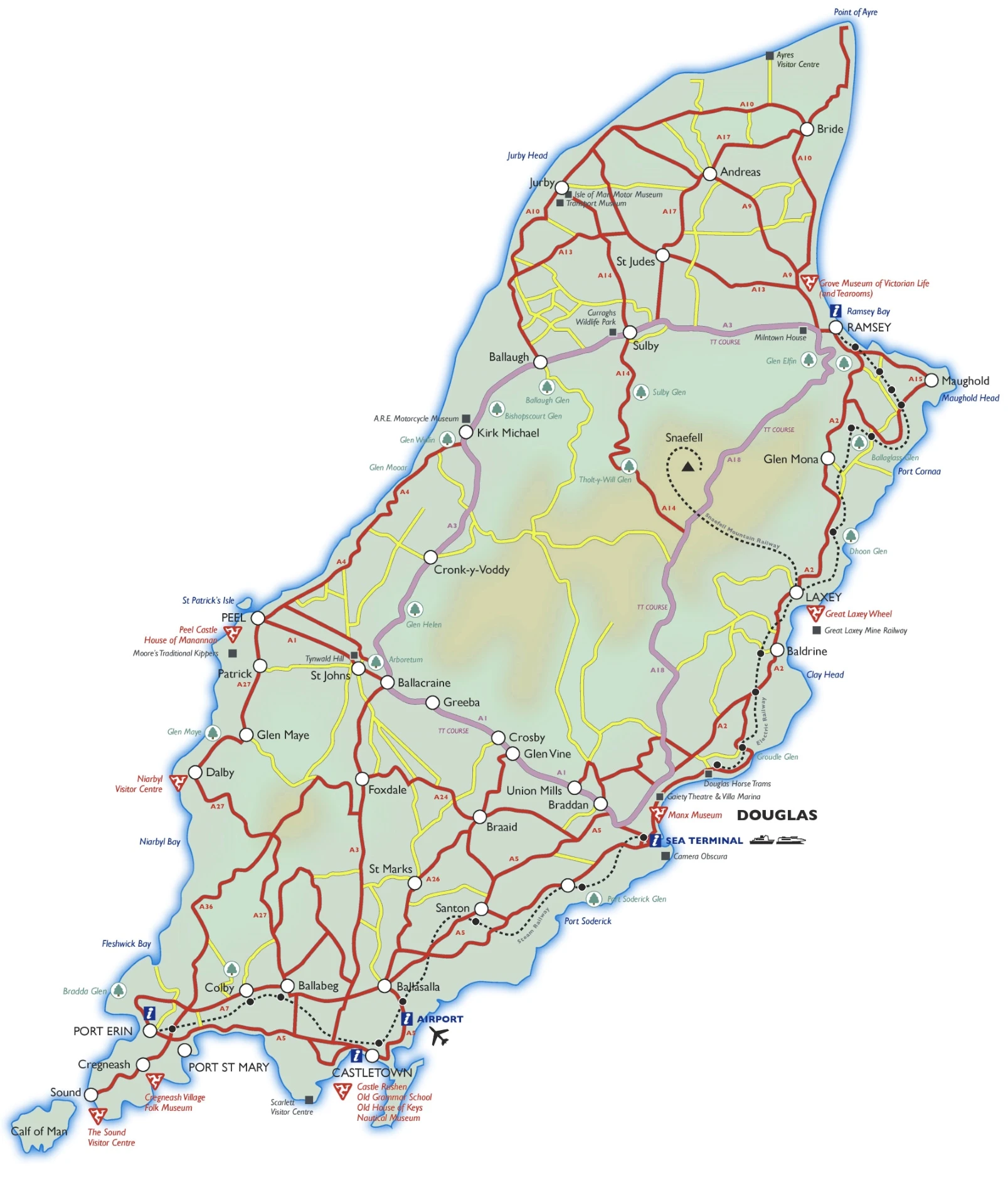
Isle of Man Driving Directions
In this post, you learned about the Isle of Man, Western Europe, an island in the Irish Sea between Great Britain and Ireland. We published some basic information about its capital Douglas, and the Manx nation.
Are you interested in visiting the Isle of Man and looking for driving directions? Click here to plan your route, or see a printable road map of Isle of Man below for an overview of the route network.
Printable map of Isle of Man
Did you know about Isle of Man?
The Isle of Man is a self-governing crown dependency located between Great Britain and Ireland in the Irish Sea. It is the only place where its national day is celebrated. The Isle of Man has its government, parliament, and legal system. The island does not form part of the United Kingdom or the European Union, but it does have one link to its British neighbors: a bridge connects it to Douglas on the Scottish mainland.
After virtually visiting the Isle of Man, you may also be interested in the neighboring countries: none.
If you liked our Google map and the Isle of Man information page,
please share it with others or save the link https://www.drivingdirections.net in your bookmarks.