
Guernsey Google Maps is a site/tool that offers a wide range of map views (topographic, satellite, street view) and navigation options, with little effort on your part, yet efficiently. If you need to plan a trip to a new place like Guernsey, Google maps are available on desktop, mobile, or tablet. This Google maps and information page is dedicated to Guernsey, Europe (47 countries), showing its location, country facts, details about its capital city Saint Peter Port, and plenty of other information which may be interesting when you visit this European state.
Quick links: Google Maps Guernsey, Saint Peter Port Google maps, Driving Directions Guernsey, Printable Road Map.
About Guernsey in a nutshell
- Conventional short form of the name: Guernsey
- The conventional long form of the name: Bailiwick of Guernsey
- Former name(s): Norman Isles
- Etymology: the name is of Old Norse origin, but the meaning of the root Guern(s) is uncertain; the -ey ending means island.
- The legal system in Guernsey: customary legal system based on Norman customary law; includes elements of the French civil code and English common law.
- Climate: Temperate with mild winters and cool summers, about 50% of days are overcast.
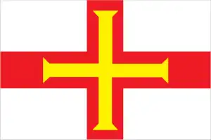
- The national symbols are Guernsey cow, donkey; national colors: red, white, yellow.
- Internet TLD: .gg
Background
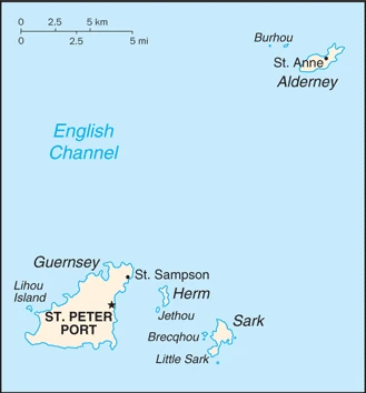
Guernsey and the other Channel Islands represent the last remnants of the medieval Duchy of Normandy, which held sway in both France and England. The islands were the only British soil occupied by German troops in World War II. The Bailiwick of Guernsey is a self-governing British Crown dependency not part of the United Kingdom. However, the UK Government is constitutionally responsible for its defense and international representation. The Bailiwick of Guernsey consists of the main island of Guernsey and several smaller islands, including Alderney, Sark, Herm, Jethou, Brecqhou, and Lihou.
Geography
Guernsey is a small island on the English Channel and is one of the most beautiful places on Earth. A place where nature has been preserved to the fullest, and it truly stands out from other spots on Earth as something that human hands have not touched.
This state is located in Western Europe, islands in the English Channel, northwest of France, under the coordinates of 49 28 N, 2 35 W, covering an area of 78 sq km with a coastline of 50 km. Guernsey is About one-half the size of Washington, DC.
Mostly flat with low hills in the southwest, with Le moulin on sark 114 m as the highest point of Guernsey, while the English Channel 0 m as the lowest poin. With a total of 78 sq km, Guernsey has 78 sq km of land and 0 sq km water surface area.
Large, deepwater harbor at Saint Peter Port.
The climate in Guernsey is as follows: Temperate with mild winters and cool summers, about 50% of days are overcast.
When you visit Guernsey, the natural hazards shall be considered: Considerable tidal variation and fast currents can make local waters dangerous.
The following major health-threatening issues shall be considered when visiting Guernsey: none.
Current environmental issues affecting the Channel Islander people: coastal erosion, coastal flooding, declining biodiversity due to land abandonment, and succession to scrub or woodland.
Google Maps Guernsey
The capital and other divisions
Capital city: Saint Peter Port found under the coordinates 49 27 N, 2 32 W, applying the time zone UTC 0 (5 hours ahead of Washington, DC, during Standard Time), using the following daylight saving time: +1hr, begins last Sunday in March; ends last Sunday in October.
Saint Peter Port, which is situated on the island of Guernsey, is a country in the British Isles of Europe. It is known for its rich culture that has been preserved primarily due to the lack of natural resources in Saint Peter Port.
Guernsey became independent on none (British Crown dependency), and its national holiday is Liberation Day, 9 May (1945).
Administrative divisions: none (British Crown dependency); there are no first-order administrative divisions as defined by the US Government, but there are 10 parishes: Castel, Forest, Saint Andrew, Saint Martin, Saint Peter Port, Saint Pierre du Bois, Saint Sampson, Saint Saviour, Torteval, Vale note: two additional parishes for Guernsey are sometimes listed – Saint Anne on the island of Alderney and Saint Peter on the island of Sark – but they are generally not included in the enumeration of parishes.
People and society
The population in Guernsey is 67,334 (July 2021 estimate), with an average of 0.24% (2021 estimate) change. That means Guernsey is the No. 203 in Sarkworld’s populated rank list. With an average of 44.3 years median age (43 years for males and 43 years for women), Guernsey ranks No. 17 on the globe’s median age rank list.
The people living in this country are the Channel Islander(s) (noun) or Channel Islander (adjective) and belong mainly to the following ethnic groups: Guernsey 52.9%, UK and Ireland 23.9%, Portugal 2.2%, Latvia 1.5%, other Europe 2.9%, other 4.6%, unspecified 12% (2019 estimate). Note: data represent population by country of birth; the native population is British and Norman-French descent.
They speak English, French, Norman-French dialects spoken in country districts’ languages and practice the following religions: Protestant (Anglican, Presbyterian, Baptist, Congregational, Methodist), Roman Catholic.
We can conclude the following about the population in Guernsey: N/A In Guernsey, we are talking about 31% (2021) of the total population is living in cities, and most of them reside in the following municipalities: 16,000 Saint Peter Port (capital city) (2018).
Industry
Financial services accounted for about 21% of employment and about 32% of total income in 2016 in this small, prosperous Channel Island economy. Construction, manufacturing, and horticulture, mainly tomatoes and cut flowers have declined. Financial services, professional services, tourism, retail, and the public sector have grown. Light tax and death duties make Guernsey a famous offshore financial center.
Guernsey is rich in the following natural resources: Cropland.
The main industrial sectors are typically tourism, banking.
The country’s export sectors are particularly strong in tomatoes, flowers, and ferns, sweet peppers, eggplant, other vegetables.
The main agro-industrial products of Guernsey are tomatoes, greenhouse flowers, sweet peppers, eggplant, fruit, Guernsey cattle.
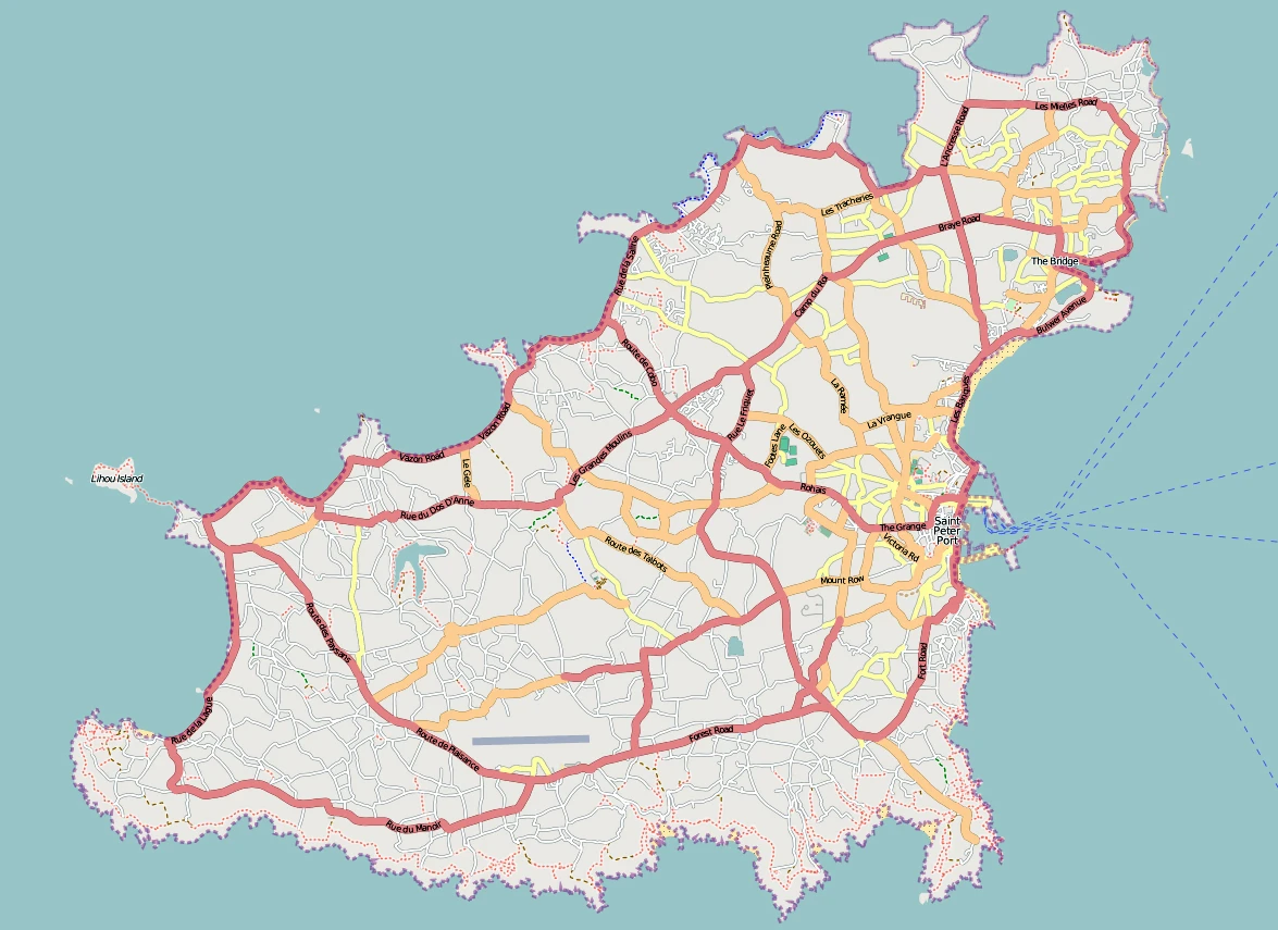
Guernsey Driving Directions
In this post, you learned about Guernsey, Western Europe, islands in the English Channel, northwest of France. We published some basic information about its capital Saint Peter Port, and the Channel Islander nation.
Are you interested in visiting Guernsey and looking for driving directions? Click here to plan your route, or see a printable road map of Guernsey below for an overview of the route network.
Printable map of Guernsey
Did you know about Guernsey?
Guernsey is an island off the coast of France that was seized from the Germans in a military occupation during World War II. After being occupied by the English, it became a British Crown dependency and, after gaining independence in the 1960s, it was granted full autonomy under Queen Elizabeth II.
After virtually visiting Guernsey, you may also be interested in the neighboring countries: France, the United Kingdom.
If you liked our Google map and Guernsey information page,
please share it with others or save the link https://www.drivingdirections.net in your bookmarks.