
Djibouti Google Maps is a site/tool that offers a wide range of map views (topographic, satellite, street view) and navigation options, with little effort on your part, yet efficiently. If you need to plan a trip to a new place like Djibouti, Google maps are available on desktop, mobile, or tablet. This Google maps and information page is dedicated to Djibouti, Africa (54 countries), showing its location, country facts, details about its capital city Djibouti, bordering countries like Eritrea, Ethiopia, Somalia, and plenty of other information which may be interesting when you visit this African state.
Quick links: Google Maps Djibouti, Djibouti Google maps, Driving Directions Djibouti, Printable Road Map.
About Djibouti in a nutshell
- Chewing the leaves of the mildly narcotic qat shrub is an age-old social ritual in Djibouti.
- Conventional short form of the name: Djibouti
- The conventional long form of the name: Republic of Djibouti
- Local long form: Republique de Djibouti / Jumhuriyat Jibuti
- Local short form: Djibouti / Jibuti
- Former name(s): French Somaliland, French Territory of the Afars and Issas
- Etymology: the country name derives from the capital city of Djibouti.
- The legal system in Djibouti: mixed legal system based primarily on the French civil code (as it existed in 1997), Islamic religious law (in matters of family law and successions), and customary law.
- Climate: Almost no rain, though the monsoon is very humid. The 109°F (45°C) heat of summer is unbearable.
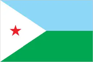
- The national symbols are red star; national colors: light blue, green, white, red.
- Internet TLD: .dj
Once under the patronage of the Italians, French and British, Eritrea, Djibouti, Somalia strategically located at the southern exit of the Red Sea have not been spoiled by nature. They have the driest region in the hot tropics and are plagued by ethnic conflict, drought, and famine. Of the three states, Eritrea has the most favorable climate. Asmara is located on the pleasant eastern slope of the Ethiopian plateau – considered the safest capital on the African continent. The port city of Masjava was once known as “the pearl of the Red Sea,” and its port is now used by Ethiopia, which became a landlocked country after Eritrea’s secession.
Eritrea’s most important cultural monument is the ruined city of Qohaito, which has only been fragmentarily excavated and was probably built on the outskirts of the ancient trading town of Koloe, part of the Kingdom of Aksum. Djibouti, the former French Afar and Issa, guard the exit of the Bab-el-Mandeb Strait. The Great Rift Valley begins here, and the continent’s deepest point and most active volcanoes are located here. Its fresh lava-covered land is barren: only a tenth of the tiny country is suitable for grazing. Somalia, the biblical Puntland, is the site of a long-running civil war.
Background
The region of present-day Djibouti was the site of the medieval Ifat and Adal Sultanates. In the late 19th century, treaties signed by the ruling Somali and Afar sultans with the French allowed the latter to establish the colony of French Somaliland. The designation continued until 1967, when the name was changed to the French Territory of the Afars and the Issas. Upon independence in 1977, the country was named after its capital city of Djibouti. Hassan Gouled APTIDON installed an authoritarian one-party state and served as president until 1999. Unrest among the Afar minority during the 1990s led to a civil war that ended in 2001 with a peace accord between Afar rebels and the Somali Issa-dominated government.
In 1999, Djibouti’s first multiparty presidential election resulted in Ismail Omar GUELLEH as president. He was re-elected to a second term in 2005 and extended his tenure in office via a constitutional amendment, which allowed him to serve a third term in 2011 and begin a fourth term in 2016. Djibouti occupies a strategic geographic location at the intersection of the Red Sea and the Gulf of Aden. Its ports handle 95% of Ethiopia’s trade. Djibouti’s ports also service transshipments between Europe, the Middle East, and Asia. The government holds longstanding ties to France, which maintains a military presence in the country, as does the US, Japan, Italy, Germany, Spain, and China.
Geography
Mainly low-lying desert and semidesert, with a volcanic mountain range in the north.
Djibouti is a city-state with a desert hinterland in northeast Africa on the Red Sea. Once known as the French Territory of the Afars and Issas, independence came in 1977.
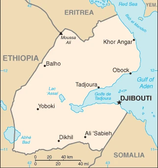
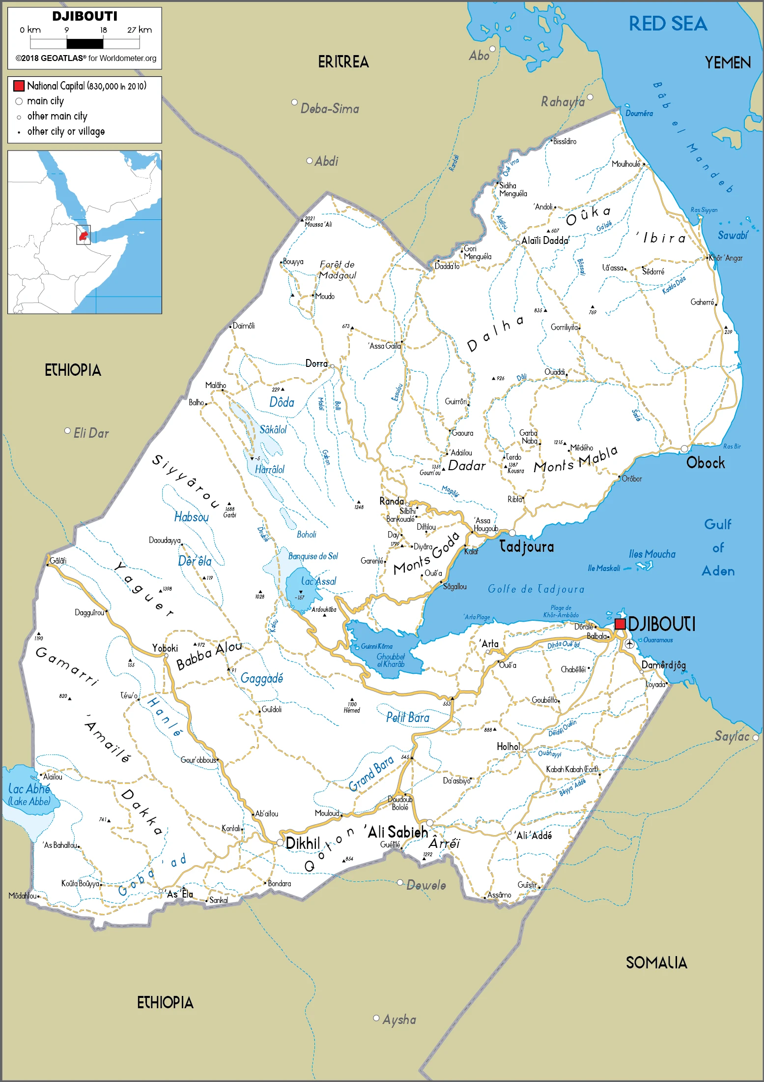
This state is located in Eastern Africa, bordering the Gulf of Aden and the Red Sea, between Eritrea and Somalia, under the coordinates of 11 30 N, 43 00 E, covering an area of 23,200 sq km with a coastline of 314 km. Djibouti is Slightly smaller than New Jersey.
Djibouti has 528 km of land boundaries and borders with (3 nations): Eritrea 125 km, Ethiopia 342 km, Somalia 61 km.
Coastal plain and plateau separated by central mountains, with Moussa Ali 2,021 m as the highest point of Djibouti, while Lac Assal -155 m as the lowest point, causing a mean elevation at 430 m throughout the country. With a total of 23,200 sq km, Djibouti has 23,180 sq km of land and 20 sq km water surface area.
Major water bodies in the country: Abhe Bad/Abhe Bid Hayk (shared with Ethiopia) – 780 sq km (saltwater lake) while there are no significant rivers.
Strategic location near the world’s busiest shipping lanes and close to Arabian oilfields; terminus of rail traffic into Ethiopia; mostly wasteland; Lac Assal (Lake Assal) is the lowest point in Africa and the saltiest lake in the world.
The climate in Djibouti is as follows: Desert, torrid, dry.
When you visit Djibouti, the natural hazards shall be considered: Earthquakes; droughts; occasional cyclonic disturbances from the Indian Ocean bring heavy rains and flash floods volcanism: experiences limited volcanic activity; Ardoukoba (298 m) last erupted in 1978; Manda-Inakir, located along the Ethiopian border, is also historically active.
The following major health-threatening issues shall be considered when visiting Djibouti: degree of risk: high (2020), bacterial and protozoal diarrhea, hepatitis A, typhoid fever, dengue fever.
Current environmental issues affecting the Djiboutian people: inadequate supplies of potable water; water pollution; limited arable land; deforestation (forests threatened by agriculture and the use of wood for fuel); desertification; endangered species.
Google Maps Djibouti
The capital and other divisions
Capital city: Djibouti found under the coordinates 11 35 N, 43 09 E, applying the time zone UTC+3 (8 hours ahead of Washington, DC, during Standard Time), using the following daylight saving time: none.
Djibouti is the capital of Djibouti and the largest city in Djibouti. It is located on the Gulf of Tadjoura, on the Gulf of Aden coast, near the confluence with the Jub-Juba River. In terms of population, it is also one of the largest cities in Africa.
Djibouti became independent on 27 June 1977 (from France), and its national holiday is Independence Day, 27 June (1977).
Administrative divisions: 6 districts (cercles, singular – cercle); Ali Sabieh, Arta, Dikhil, Djibouti, Obock, Tadjourah.
People and society
The main ethnic groups are the Issas in the south and the nomadic Afars in the north. Tensions between them developed into a guerrilla war in 19911994. Smaller tribal groups make up the rest of the population, and the rural peoples are primarily nomadic. Wealth is concentrated in Djibouti city. France exerts considerable influence in Djibouti, supporting it financially and maintaining a naval base and a military garrison.
The population in Djibouti is 938,413 (July 2021 estimate), with an average of 2.01% (2021 estimate) change. That means Djibouti is the No. 162 in the world’s populated rank list. With an average of 24.9 years median age (23 years for males and 23 years for women), Djibouti ranks No. 163 on the globe’s median age rank list.
The people living in this country are the Djiboutian(s) (noun) or Djiboutian (adjective) and belong mainly to the following ethnic groups: Somali 60%, Afar 35%, other 5% (primarily Yemeni Arab, also French, Ethiopian, and Italian).
They speak French (official language), Arabic (official language), Somali, Afar languages and practice the following religions: Sunni Muslim 94% (nearly all Djiboutians), Christian 6% (mainly foreign-born residents).
We can conclude the following about the population in Djibouti: The most densely populated areas are in the east. The largest city is Djibouti, with a population of over 600,000. No other city in the country has a total population over 50,000, as shown in this population distribution map. In Djibouti, we are talking about 78.2% (2021) of the total population is living in cities, and most of them reside in the following municipalities: 584,000 Djibouti (capital city) (2021).
Industry
Djiboutis significant assets are its ports in a key Red Sea location.
Djibouti’s economy is based on service activities connected with the country’s strategic location as a deepwater port on the Red Sea. Three-fourths of Djibouti’s inhabitants live in the capital city; the remainder is nomadic herders. Scant rainfall and less than 4% arable land limits crop production to small quantities of fruits and vegetables and most food must be imported., Djibouti provides both a transit port for the region and an international transshipment and refueling center. Imports, exports, and reexports represent 70% of port activity at Djibouti’s container terminal. Reexports consist primarily of coffee from landlocked neighbor Ethiopia. Djibouti has few natural resources and little industry.
Therefore, the nation is heavily dependent on foreign assistance to support its balance of payments and finance development projects. An official unemployment rate of nearly 40% – with youth unemployment near 80% – continues to be a significant problem. Inflation was a modest 3% in 2014-2017, due to low international food prices and a decline in electricity tariffs., Djibouti’s reliance on diesel-generated electricity and imported food and water leave average consumers vulnerable to global price shocks, though, in mid-2015, Djibouti passed new legislation to liberalize the energy sector.
The government has emphasized infrastructure development for transportation and energy, and with the help of foreign partners, particularly China, Djibouti has begun to increase and modernize its port capacity. In 2017, Djibouti opened two of the most significant projects in its history, the Doraleh Port and Djibouti-Addis Ababa Railway, funded by China as part of the Belt and Road Initiative country’s ability to capitalize on its strategic location.
Djibouti is rich in the following natural resources: Potential geothermal power, gold, clay, granite, limestone, marble, salt, diatomite, gypsum, pumice, petroleum.
The main industrial sectors are typically construction, agricultural processing, shipping.
The country’s export sectors are particularly strong in various animals, chlorides, dried legumes, industrial fatty acids/oils, coffee, chickpeas (2019), partnering with these nations: Saudi Arabia 42%, India 15%, China 14%, Egypt 5%, South Korea 5% (2019). The export trade resulted in $5.15 billion. Note: Data are in current year dollars (2019 estimate). In a global export rank, values resulted in Djibouti’s position of 126.
Land use in Djibouti: 0.2% (2018 estimate) forest, 26.4% (2018 estimate) other.
The arable land area is 0.1% (2018 estimate), and the agricultural land is 73.4% (2018 estimate). Land use for permanent crops 0% (2018 estimate), permanent pasture 73.3% (2018 estimate). The sum of the area of the irrigated land is 10 sq km (2012).
The main agro-industrial products of Djibouti are vegetables, milk, beef, camel milk, lemons, limes, goat meat, mutton, beans, tomatoes.
The country typically needs to import: refined petroleum, fertilizers, iron sheeting, cars, palm oil (2019), partnering with the following nations: China 43%, United Arab Emirates 15%, India 7%, Turkey 5% (2019) in a sum value of $4.76 billion. Note: data are in current year dollars (2019 estimate) $4.19 billion. Note: data are in current year dollars (2018 estimate). This sum value on the global ranking list of imports resulted in Djibouti 141.
Djibouti Driving Directions
In this post, you learned about Djibouti, Eastern Africa, bordering the Gulf of Aden and the Red Sea, between Eritrea and Somalia. We published some basic information about its capital Djibouti, and the Djiboutian nation.
Are you interested in visiting Djibouti and looking for driving directions? Click here to plan your route, or see a printable road map of Djibouti below for an overview of the route network.
Printable map of Djibouti
Did you know about Djibouti?
Djibouti is a fascinating country with a rich culture, a beautiful coastline, and unique biodiversity on the African continent. It’s less than half the size of Oregon. It doesn’t have any natural resources to rely on, but it exports some seafood and hides.
After virtually visiting Djibouti, you may also be interested in the neighboring countries: Eritrea, Ethiopia, Somalia.
If you liked our Google map and Djibouti information page,
please share it with others or save the link https://www.drivingdirections.net in your bookmarks.